- Capital
- Harare
- Independence
- 18 April 1980
- Population
- About 15.2 million (2022 census)
- Area
- 390,757 km²
- Official languages
- 16, including English, Shona and Ndebele
- Currency
- Zimbabwe Gold (ZiG); the US dollar is also widely used
- Time zone
- UTC+2, one hour ahead of Stockholm in winter
The name Zimbabwe comes from the Shona dzimba dzemabwe, “houses of stone”, after the great stone city built here between the 11th and 15th centuries.
Zimbabwe is a landlocked country in southern Africa, between the Zambezi and Limpopo rivers. It borders Zambia to the north, Mozambique to the east, South Africa to the south and Botswana to the south-west. Harare is the capital and largest city; Bulawayo is the second.
Most of the country is a high plateau, which gives it a mild, subtropical highland climate. The rains fall in summer, from November to March. Winter nights can drop below 5 °C, while summer days rarely pass 32 °C, except in low-lying areas such as the Zambezi valley.
Five World Heritage Sites
- Mana Pools National Park
- Great Zimbabwe National Monument
- Khami Ruins National Monument
- Mosi-oa-Tunya / Victoria Falls, shared with Zambia
- Matobo Hills
Zimbabwe also holds some of the largest platinum reserves in the world, and its farming, mining and tourism make it a gateway to the markets of southern Africa.
History
From the San people around 200 BC to independence on 18 April 1980.
Culture
Languages, music, stone sculpture, food and traditions.
National symbols
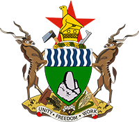
The flag, the coat of arms, the Zimbabwe Bird and the national anthem.
Provinces & map
A map of Zimbabwe and its provinces, from Harare to Matabeleland.